
“], “filter”: { “nextExceptions”: “img, blockquote, div”, “nextContainsExceptions”: “img, blockquote”} }”>
Get access to everything we publish when you
>”,”name”:”in-content-cta”,”type”:”link”}}”>sign up for Outside+.
In planning this story, we set out to do the impossible: find the best hike in each state. Turns out, “best” means something a little different to everyone. So rather than tinker with formulas, we turned to our most trusted source: you. Hikers from across the country flooded our inboxes and DMs to tell us about their favorite trail. We heard compelling descriptions of crowd-free sunset views, of shimmering alpine lakes, of nostalgia for places with personal significance, and so much more. From there, we narrowed the nominees down to these 50 picks. Our list might be contentious, but behind each entry is a passionate champion who convinced us that their trail is worth visiting. So, are these really the best hikes in the US? Read on, and decide for yourself.
Leaf-covered treadpath on Alabama’s Pinhoti National Scenic Trail.
Alabama: Pinhoti National Scenic Trail
Length: 337 miles
Not many people know about the fantastic hiking in Alabama, and the Pinhoti Trail is this underrated state’s crown jewel. On my favorite section, about 10 miles from the trail’s southern terminus, I find solitude from step one. My daughter and I hike along a creek, where mini waterfalls surprise us as we wander under a canopy of fragrant longleaf pine and towering oak trees. Mile after mile, we don’t see any other hikers. The Pinhoti is full of unexpected delights, but they don’t come easy. My feet grow sore from the ups and downs, but I’m eventually rewarded: We reach an overlook of the southernmost Appalachians; views over their green ridgelines make every step worth it.
Despite the trail’s remoteness, a strong hiking community makes me feel safe and welcome as I section-hike the Pinhoti, preparing myself for an eventual thru-hike. Because of its length and reputation for being well-maintained, the Pinhoti serves as a training ground for hikers preparing for treks on some of America’s more popular long trails. I read these hikers’ rave reviews of the Pinhoti online and can’t help feeling a sense of pride; I’ve always known it was special.
As my daughter and I hike back the way we came, I think about how the next time I walk this section of trail, I may be starting a thru-hike of my own. I can’t wait.
Sarita Johnson of Montgomery, AL, has been section-hiking the Pinhoti Trail for three years between working full time and caring for her three kids. “I always carry a lightweight chair in my pack. I’ve gotten enough bug bites along the Pinhoti that it’s worth bringing something to sit on,” she says.
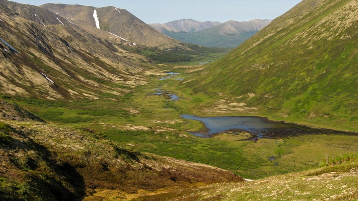 Morning on Resurrection Pass in Chugach National Forest, Alaska. (Photo: mtnmichelle/iStock via Getty Images)
Alaska: Resurrection Pass Trail
Length: 38 miles
I descended into the valley as dusk settled into the nooks of Chugach National Forest. My feet ached—this the most miles they had seen since I climbed on board a commercial fishing boat at the end of May four months ago. Sixteen hours earlier, I had been packing for three nights on Resurrection Pass, looking forward to processing my summer through the repetitive motion of a hike in solitude along the 38-mile trail.
Dena’ina Ełnena, (Land of the Dena’ina Dené Peoples) hosts some of the most well-loved and accessible trails in Alaska. In the winter, Resurrection Pass is a popular ski area, and in summer provides ample hiking, biking, and horseback riding opportunities. From a forest floor layered with heshkegh ka’a (devil’s club) and protected by a thick canopy of spruce and ancient cottonwood, the trail ascends to an upper valley of rolling tundra.
Resurrection Pass connects the Turnagain Arm, a narrow channel between the Chugach and Kenai mountains, and the Kenai River, a stretch of glacial blue majesty which used to host one of the largest king salmon runs in Alaska. This area has seen an influx of change since Captain Cook’s violent voyage of 1778, which resulted in the colonization of Alaska. Within my lifetime, fire and beetle kill have altered the landscape, and traffic has increased on the Kenai Peninsula as tourists and new residents seek “the last frontier.”
While walking, I thought of my grandfather, a Deg Xit’an Dené man who has stories of hiking 40 miles in a day looking for beaver, martin, lynx, wolverine, and snowshoe hare. Trails like the Resurrection have always connected Indigenous peoples for trade and travel between areas of natural abundance. Hiking allows us to move with intention, and asks us to pause and begin to understand the balance needed to take only what is necessary from these places.
Despite its proximity to Anchorage, you can escape the sound of engines and decompress on the trail. If you get the chance, I encourage you to travel at any pace that allows you to reflect on the vibrance of the land, the use of trails when they were necessary parts of life, and recognize the original peoples of the land, the Dene’ina Dené, who have seen a massive influx of settlers on their land.
Deenaalee Hodgdon is a nomadic Deg Xit’an Dené and Sugpiaq descended from the Yukon River and Bristol Bay. They split the seasons between subsistence and commercial fishing in Bristol Bay and various forms of storytelling and artwork through the winter. Deenaalee is currently telling stories on Lower Tanana Dené lands in Fairbanks, AK. Their favorite trail snacks are salmon strips and dried moose meat.
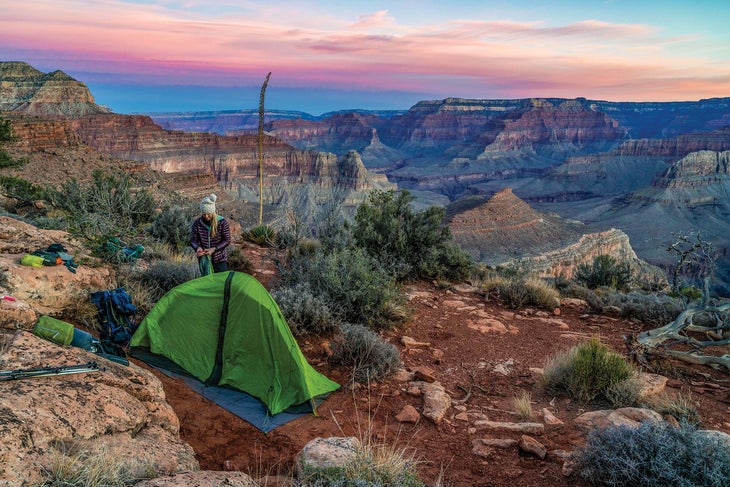 Escape the crowds on the Grand Canyon’s Hermit-Tonto-Boucher Loop. (Photo: Laurence Parent)
Arizona: Hermit-Tonto-Boucher Loop
Length: 23.5 miles
You can escape the crowds at the Grand Canyon with this three-night loop, but you will have to earn the privilege. This adventure-packed route is perilously steep at times, with exposure thrown in for extra thrills. But when you watch the sun rise and set just a few steps from your tent on a broad ledge 1,200 feet below the South Rim’s Yuma Point, you’ll forget the suffering it took to get here.
Do the loop counter-clockwise so you descend the better-maintained Hermit Trail and climb up the precipitous Boucher Trail. The first day you’ll drop almost 4,000 feet in about 8 miles while overlooking the gaping chasm of Hermit Canyon, a sheer-walled defile so dramatic that it could be a national park all by itself. At Hermit Camp, soak your weary feet and knees in the clear creek while you filter water.
The next day you’ll leave the tourists far behind as you follow the Tonto Trail 4.6 miles, hugging the Inner Gorge Rim on your way to Boucher Creek. Take in vertigo-inducing sights of the roaring Colorado River almost straight below, then relax beside a perennial stream before you mosey 1.8 miles down to the mighty Colorado. The third day, grind your way up the Boucher Trail, a route park rangers call the most difficult, hazardous, and demanding on the South Rim. Believe the hype: You climb 1,800 feet to the top of the Red Wall Limestone in only 1.5 miles. After an easy 0.7-mile traverse, climb another 1,000 feet steeply up through the red rock. Near the top is the crux of the entire hike: The final scramble is the steepest, most exposed part of the entire loop. This section became even more difficult in 2021 when a rockslide covered it with loose rocks and debris. Use great caution climbing it.
Soon enough you’ll be relaxing at your dry camp on the sandstone promontory below Yuma Point. Drink in the sunset view, possibly the best in the canyon below the rim; the campsite lies on a point with a drop-off of hundreds of feet on three sides, offering broad views across the entire Grand Canyon. You’ve earned it. The next day’s final 5 miles will be a piece of cake.
Laurence Parent came to love hiking naturally, having grown up in the southwestern national parks where his father worked. While he was once an engineer, for many years he’s been a full-time writer and photographer, particularly of outdoor subjects. Among his 45 books are three hiking books for Falcon Guides on New Mexico and Texas. He lives in Prescott, AZ.
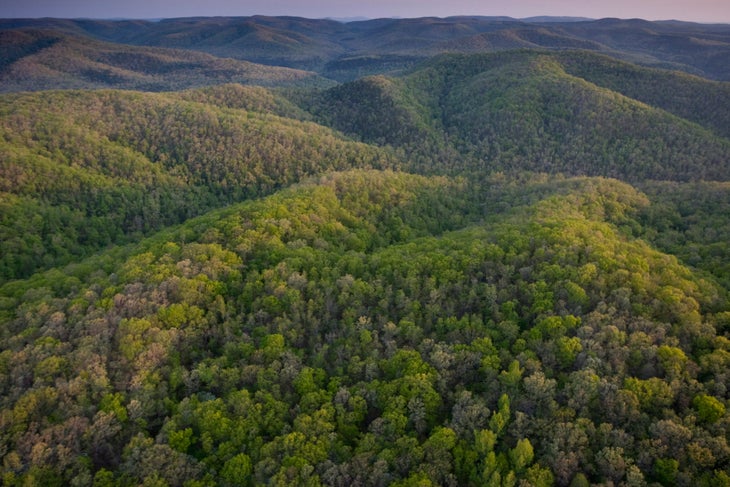 Aerial view of Richland Creek Wilderness at sunrise, Ozark Highlands Trail, Arkansas. (Photo: Peter Essick via Getty Images)
Arkansas: Ozark Highlands Trail Through Hurricane Creek Wilderness
Length: 10.2 miles
The midriver pool by our campsite was still, deep, and the kind of teal blue that seemed to melt away the summer heat just by looking at it. This was what we had come for, driving eight hours from the plains of central Oklahoma along twisting country roads for a taste of Hurricane Creek in Arkansas’s Ozark Mountains.
My dad and I arrived at the trailhead near Fort Douglas for this section of the 270-mile Ozark Highlands Trail and emerged from the car to near-solid heat and a chorus of cicadas buzzing from the surrounding beech trees. It’s best to hike in this area during the early spring or fall when temperatures are milder, making for a more pleasant climb out of the sloping river valley. The first time I hiked this trail, the creek’s clear blue waters and milky waterfalls struck a sharp contrast with the brittle brown of the hardwood forest. As someone who grew up in the Pacific waters of O’ahu, I seek places to submerge myself, preferring warm forest pools to icy mountain plunges. So we returned at a time when the languishing portions of the creek were more amenable to swimming. We were not disappointed.
Our second night out on the trail, we set up camp adjacent to a large slab of shale, pockmarked with small pools of rainwater. The canopy opened to reveal the creek rushing just below, depositing sun-warmed waters into yawning blue swimming holes. I spent an unforgettable afternoon diving endlessly into the creek and snapping pictures of the scalloped, moss-dappled cliffs as iridescent black and blue butterflies flitted by. It’s a memory I won’t soon forget.
Kaily Heitz is a postdoctoral fellow in the Department of Geography and Environment at the University of Texas at Austin, and is a lifelong backpacker and climber. Her go-to trail dinner is tuna macaroni and cheese. She recommends that folks pack bug spray, a good map, and a swimsuit for this trail. Kaily has called Stillwater, OK, Chicago, IL, and Oakland, CA home.
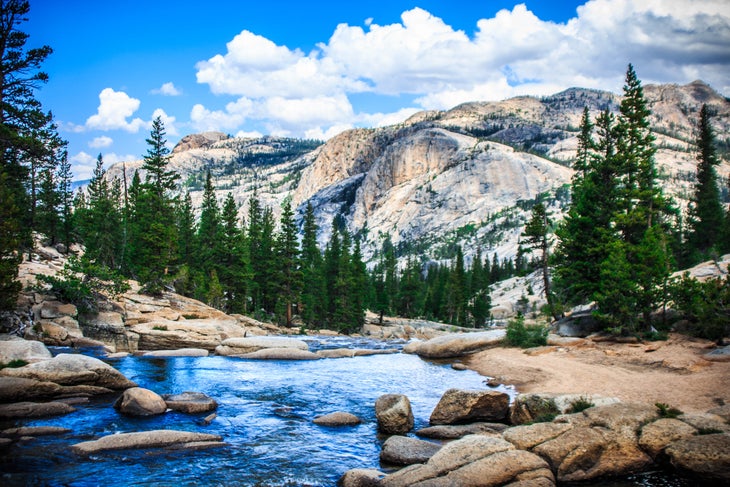 The PCT from Tuolumne to Agnew Meadow has stellar alpine views. (Photo: Scott Angus/500px via Getty Images)
California: PCT from Tuolumne to Agnew Meadow
Length: 27.5 miles
“There’s no bathroom here,” the Yosemite ranger says, her back to us. “Oh, we’re actually here for our permits,” Dad responds. People don’t usually backpack the Ansel Adams Wilderness in mid-October, the ranger’s furrowed brow says. And apparently she’s right. Over this stretch of the Pacific Crest Trail, we meet only a handful of other parties. There’s plenty else to see: 8 miles of the Lyell Fork of the Tuolumne snaking along the canyon’s glaciated granite; the morning sun climbing above the forested Kuna Crest, softening the frozen soil surrounding our dispersed campsite; the snow-dusted Cathedral Range and partially-frozen glacial cirque lakes as we ascend Donahue Pass towards the Great Western Divide and the eastern Sierra.
I grew up not far from here, in the Auburn foothills of the Sierra. My dad’s been backpacking since the 1970s, but has never hiked the range’s east side. “I just love the west,” he confesses as we pump water before our final push up the pass. “And I’ve always had a bias against the east.” His smile is guilty: He should know better. Mine is eager: He’ll soon find out.
A few thousand feet later, we step into Inyo National Forest and onto dark eastern Sierra soil. Banner Peak juts skyward from the Ritter Range, celebrating itself amongst a history of earthquakes and glaciers, weather and time. Spires of metamorphic lava rock climb up Koip Crest to our left. A grove of solitary foxtail pine stands solemnly in the sedge grass valley below. Prints of gray ground squirrel and California coyote and brown bear appear in six inches of snow that amass around our tent on our fourth and final morning. It’s all the best that this region has to offer.
“I guess there’s a lot more to the eastern Sierra,” Dad grins as we leave the PCT through the Agnew Meadow trailhead. Mammoth Mountain is now in front of us. Metavolcanic minarets are to our left, Devils Postpile to our right. Peaks and valleys and rivers and forest are behind us. And over 2,600 yet-to-be-explored miles of the PCT are all around.
Benje Williams is a writer living in New York City and cofounder of Understory, a nonprofit working to restore forest landscapes. He is a Public Voices fellow with the OpEd Project and Yale Program on Climate Change Communication and loves hiking with old-school topo maps.
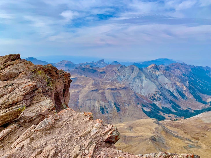 The view from Uncompahgre Peak (Photo: Ashley Bennett/iStock via Getty Images)
Colorado: Uncompahgre Peak
Length: 13.4 miles
Uncompahgre Peak is a mountain of haves and have-nots. What it does have: proud status as the sixth-tallest Colorado Fourteener; an exciting, keeps-you-on-your-toes Class 2 scramble up to the summit plateau; and finally, commanding views of the San Juans, the state’s most roughhewn and remote range.
What Uncompahgre lacks: crowds, a characteristic that it would surely share with its fellow Fourteeners if it was closer to Denver (or, really, a population center of any notable size; tiny Lake City nearby is a great trail town, but it too is delightfully remote). The mountain also doesn’t have the exposure, ultralong approaches, and a slog out that seem befitting for a peak of this stature.
All that makes for an unspoiled Colorado summit experience. To up the wow-factor even more, the best approach to Uncompahgre is from the Matterhorn trailhead. While the Nellie Creek trailhead is the closer option, setting out from Matterhorn Creek sends you through bowls of expansive alpine meadows, where Sound of Music meets the Centennial State.
You’ll pass beneath the craggy, triangular east face of the Wetterhorn—another Fourteener—before cresting a mini-pass and laying eyes on Uncompahgre in all its blocky glory, a ship set sail on a sea of high-altitude greenery. The trail that curls up the mountain’s southeast ridge is hidden from view, and the ascent looks intimidating. Stopping again at this point on the way back, the “Dang, I climbed that?” factor will be off the charts.
While Uncompahgre can be done as a dayhike, the meadows surrounding the peak offer pristine camping. And don’t worry, you can brag about how cool it was when you get home: The crowds aren’t coming here any time soon.
Eli Bernstein is Backpacker’s senior gear editor, originally hailing from New Rochelle, NY. He climbed Uncompahgre Peak on his first backpacking trip after moving to Colorado, and that four-day circuit remains his favorite hike.
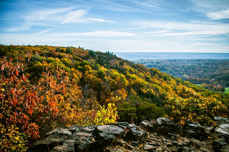 (Photo: “Sleeping Giant State Park” by Bob P. B. is licensed under CC BY 2.0)
Connecticut: Blue Trail, Sleeping Giant State Park
Length: 2.9 miles
That this verdant quad-buster of a hike exists in one of the most densely populated areas of the country is a miracle. The Blue Trail, my go-to for a weekend respite or even a pre-work stress release, is just 15 minutes from New Haven. Its craggy sandstone and conglomerate rocks and 600-feet-per-mile grade deliver an injection of true adventure in an area where that’s not a common word. The Blue Trail begins along the Mill River and climbs quickly—at times approaching a 60-percent grade—through hickory, beech, and oak trees. Steep, non-technical scrambling leads you to a stone lookout tower built in the 1930s at the mile-and-a-half mark. From the tower’s upper level, enjoy views over green hills (in fall, see vibrant reds and yellows), the nearby summit of 676-foot Mt. Carmel to the east, and the blue waters of Long Island Sound to the south. While this particular trail offers a nice physical challenge, easier paths nearby lead to the same view, so there’s a route for everyone. From the top, you can descend the Tower Trail to turn your outing into a loop hike, or go back the way you came. It’s the fastest way to escape the city bustle for some nature therapy.
Julia Monk is a PhD student in ecology at Yale University, originally from New York City. Her fieldwork takes her hiking deep into remote sections of the Andes in Argentina, where sometimes she doesn’t see other people for weeks at a time. Her field site lies along the Inca Trail.
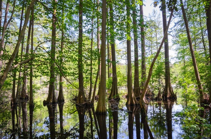 Flooded forest in Trap Pond State Park (Photo: zrfphoto/iStock via Getty Images)
Delaware: Bob Trail
Length: 4.5 miles
The interlocking trails at Trap Pond State Park are best measured in one simple way: smiles per mile.
You won’t mistake the 2,685-acre park for the vastness of the desert southwest or the otherworldliness volcanic northwest—as the nation’s second-smallest state, Delaware doesn’t have that kind of real estate.
But if you want to introduce kids to the outdoors, clear your head of the weekday clutter, or launch a mini-vacation, the park’s Bob Trail will do nicely. It is a terrific introduction to the Chesapeake Bay Gateways and Watertrails Network, a regional partnership with the National Park Service.
The 4.5-mile trail—just call it “The Bob”—is the longest in the park. Bald cypress trees poke out of the wetlands along the trail singly and in small groves, their bulbous trunks casting spooky reflections and their feathery needles rustling in the breeze. You don’t have to wait until sundown to spin a yarn about pirates and buried treasure on The Bob.
You are never far from the water’s edge, either. The Bob leads you past the boat launch for Trap Pond and adjacent Raccoon Pond for paddling, fishing, and birding opportunities (see great blue herons, belted kingfishers, turkey vultures, and more). An adjacent campground has tent sites, cabins, and yurts. In such a small state, you can still have big adventure.
Candy Thomson spent 40 years gathering facts as a journalist and an equal amount of time spinning tales on the trails and waterways of the Mid-Atlantic. Passing along tips as the Baltimore Sun’s outdoors writer was the best job ever. Having the right outdoor gear was Thomson’s ticket to covering five Olympics.
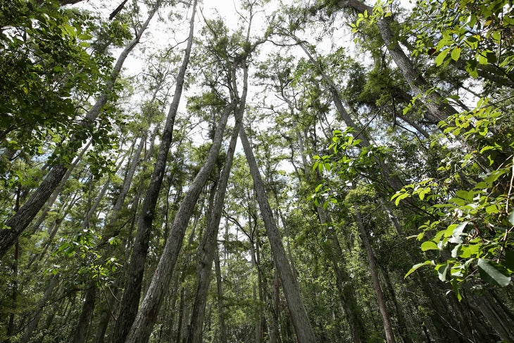 Looking up at the tall trees in Florida, USA. (Photo: JillianCain/iStock via Getty Images)
Florida: Florida Trail Through Rice Creek Conservation Area
Length: 2.4 miles
My favorite way to kick off the new year is with a hike, and this year, I decided to visit my favorite section of the Florida Trail at Rice Creek Conservation Area. On New Years Day, I pulled up to the trailhead at what was once an 18th century rice plantation. As soon as I stepped out of the car, two bald eagles flew overhead. Wildlife sightings of everything from otters to alligators aren’t unusual on this trail, but this felt like an especially good omen. Rice Creek is mostly swampland, and the hike took me over narrow boardwalks and bridges through cypress groves and mixed forest. When the boardwalks disappeared, I hopped between large palmetto leaves like stepping stones over the marshy ground. Just off the trail sits the seventh-largest cypress tree in the state; knobby cypress “knees” protrude from the ground near its base, creating a mystical effect. I thought to myself that it looks like somewhere you might find a gnome living.
Rice Creek makes for a good dayhike-loop, but the Florida Trail stretches hundreds of miles in either direction, making it a perfect section on a longer trek, too. The conservation area features one stilted shelter that thru-hikers refer to as the “Rice Creek Hilton.” As I hiked back to my car, I thought about the rich history of this area, its evolution from wild swamp to a commercial plantation and now back to conservation land. I’m only here for a small portion of this history, but those huge cypress trees have seen it all.
Chelsea Collinson, from Gainesville, FL, is the community outreach manager for the Florida Trail Association. Collinson has completed the 52 Hikes Challenge (one hike a week for a whole year) twice—going on three times. She’s had to end a hike early on multiple occasions due to an alligator blocking the trail.
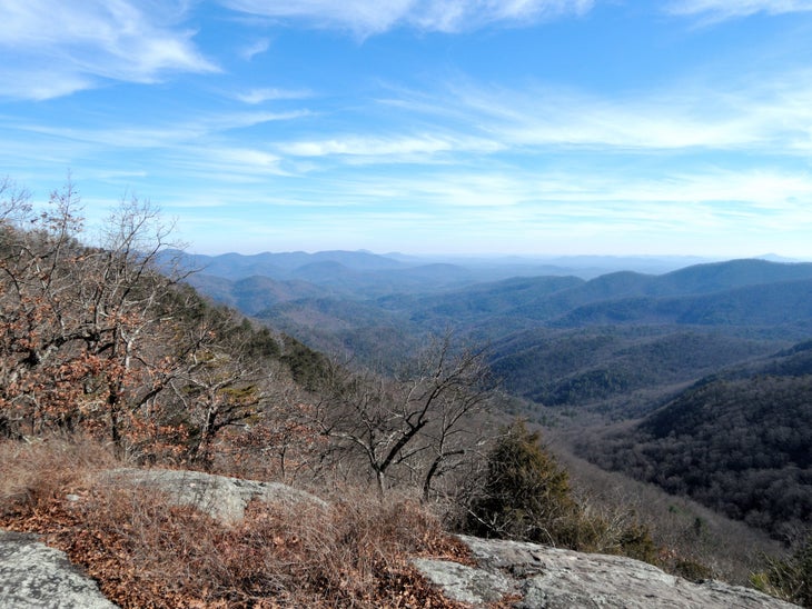 A winter view in Georgia. (Photo: “Overlook” by TimothyJ is licensed under CC BY 2.0)
Georgia: AT from Neels Gap to Hogpen Gap
Length: 6.5 miles
As soon as I start the initial climb on my first multiday hike along the Appalachian Trail, I know I packed too much gear. My pack, loaded down with camera equipment, sits heavy on my shoulders, the imbalance threatening to tip me over. But as soon as I come to the first viewpoint atop 3,806-foot Levelland Mountain, I forget all about the weight. Layers of blue-green mountains stack into the distance. This route links more than half a dozen peaks over 3,500 feet, and the ups and downs give me a sense of pride at every overlook. It’s rare to stay so high in Georgia, but on this trail the long views don’t stop—on 3,783-foot Green Cliff Top, a sheer dropoff gives way to westward views over the green expanse of Chattahoochee National Forest. I’m panting for breath in the summer heat as I take in the 180-degree vista, but it couldn’t be a more perfect day. The sky is blue, the views are expansive, and I have one more mountain ahead of me before I reach Hogpen Gap, the end of my hike. These handful of miles have made me a backpacker for life.
Kimie Yates is a landscape and adventure photographer from Macon, GA. She travels in her van with her husky, Bodhi, and never leaves home without her camera.
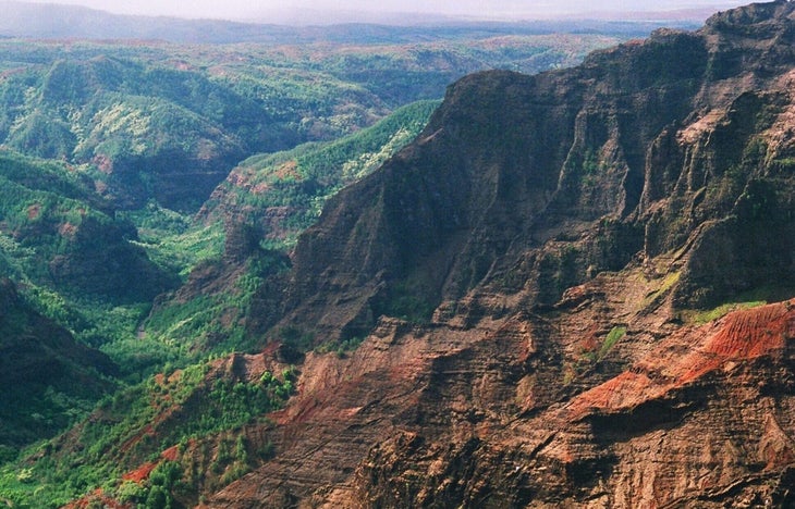 A view of the cliffs and tropical montane vegetation of the Waimea Canyon, located on the western side of Kauai, Hawaii. Image courtesy Randolph Femmer/USGS. June, 2007. (Photo by Smith Collection/Gado/Getty Images).
Hawaii: Kukui Trailhead to Lonomea Backcountry Site
I stand alongside the river, watching the water staircase its way down the gorge over boulder fields and cliff edges. It branches off into waterfalls, filling inviting pools below, while the red, towering canyon walls rise more than 2,000 feet above my head.
The red rocks are reminiscent of the southwest, but the river banks—full of guava, avocado, mango, and kukui nut—are constant reminders of my tropical location.
I’m deep within the backcountry of Waimea Canyon, also known as the “Grand Canyon of the Pacific,” on Kauai. It’s 3,600 feet deep, a mile wide, and close to 14 miles long. The rim of Waimea Canyon is one of the most-visited places on Kauai, riddled with scenic overlooks and criss-crossed by helicopter fly-overs. Down here, though, it still feels like one of the least-explored places in Hawaii, where the wilderness remains untamed. Four swimmable pools, filled by waterfalls and within a short walk of the most remote campsite, Lonomea, offer absolute tranquility and the chance to swim beneath the towering canyon walls.
It’s not the Hawaii you picture when you close your eyes—it’s nowhere near the beach, and there’s more red rock than rainforest— but that’s exactly why I love it. All the other islands have those beautiful beach hikes or volcanic terrain; this 5.3-mile adventure is one of a kind, and not overcrowded like other trails. With permits limited to one eight-person group per night, Lonomea guarantees privacy and even a little bit of convenience, with a covered shelter, cooking pit, and composting toilet in the wooded area adjacent to the river. With plenty of side canyons to explore, I recommend a two-night stay. Hot tip: Pack a small, inflatable inner tube to ensure maximum relaxation in the waterfall pools.
Will McGough runs tent testing for Backpacker and is based in Palisade, CO. He is currently obsessed with slow-cooking soups over a campfire, which often makes his friends hangry.
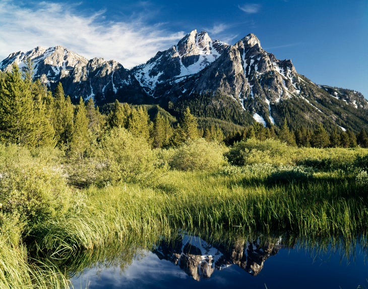 Grassy valley bottoms on Idaho’s Sawtooth Wilderness Loop. (Photo: ClassicStock / Contributor/Archive Photos via Getty Images)
Idaho: Sawtooth Wilderness Loop
Length: 63 miles
This loop is a contender for best in the country—not just best in the state. Located near Stanley, Idaho and contained within the Sawtooth Wilderness, the hike begins at the Grandjean Campground and immediately climbs into the subalpine. Most backpackers go clockwise to get the scar of a wildfire behind them at the beginning of the trip. After 10 miles of burn, the trail rises over an alpine pass at 8,700 feet before joining the shores of Sawtooth Lake, the largest on the loop. From the lake, hundreds of jagged rock spires line 10,000-foot ridgelines in all directions. Sawtooth Lake is the perfect spot to camp on night one, with numerous well-used campsites.
From the peaceful lake, a 3,000-foot descent over 6 miles ends at the first bail-out option at the Redfish Creek-Baron Creek Trail junction. From there, begin a long, slow climb along Baron Creek. The ascent back to 9,000 feet is surrounded by small ponds, alpine meadows, and aspen groves. Baron Lake and Upper Baron Lake offer some of the most scenic campsites of the entire wilderness, with the upper lake nestled just one step up from the lower lake among a backdrop of toothy granite ridgeline.
Perfectly still water reflects the unique rocks of the landscape, and Redfish Lake Creek flows between lakes on the descent to the Mt. Cramer Trail. On the way to the high point, lake after lake quietly sit among amphitheaters of granite, with the final switchbacks to 9,466 feet visible on the ridge above. After all that hard-earned elevation, the route stays high for 14 miles. A slow descent along a gentle creek closes the loop.
The consistent views of summits, clear mountain lakes, and wildlife sightings—from elk to wolverines—make this loop one of the most rewarding mile-for-mile backpacking trips I’ve ever done.
Jeff Garmire has hiked 30,000 miles through 42 states but still has an irrational fear of horses, especially when attempting to share the trail with them. He is from Bozeman, MT.
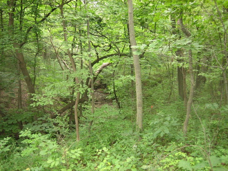 Dense understory in Illinois’s Swallow Cliff Woods. (Photo: “00144.jpg” by nim is licensed under CC BY-SA 2.0)
Illinois: Swallow Cliff Woods
Length: 8 miles
In Illinois, any topography is exciting. Growing up, that made Swallow Cliff, only a few miles from my childhood home, a near-mythical place. Formed 12,000 years ago by retreating glaciers, the 100-foot-tall bluff has served as the home to a ski jump, a set of toboggan slides, and a 125-step limestone staircase carved by Works Progress Administration laborers in 1930. Though the ski jump was torn down in 1943, the stairs still stand, and are often covered by hordes of suburbanites getting their cardio in.
Beyond the crowds lie 20-plus miles of gravel and dirt trails. In high school, my cross country team ran these trails almost every day, creating our own names for each segment and loop. “Double Loop,” as we called it, marked in yellow on the map and trail markers, winds 8 miles through oak and hickory forest, wetlands, and meadows. Creeks flow through the bottom of steep ravines, and expansive views of the open woodland ecosystem await at the top of the bluff.
To do the loop, start from the Swallow Cliff Woods North parking lot, head east on the yellow trail, following the bottom of the bluff under La Grange Road and across Kean Avenue before you swing around and climb up to the top. Once you cross under La Grange a second time, stay on the yellow trail to enter the second part of “Double Loop,” crossing Willow Springs Road and heading back down the bluff (along “Forever Hill,” as it was known to us). After conquering a series of steep rollers and going over Willow Springs Road again, the trail returns to the bottom of the bluff and deposits you once again at the parking lot. You’ll head back to the surrounding urban sprawl having passed through the most remote place in Cook County with sore quads and a smile on your face.
David Gleisner is an avid runner, hiker, and writer from Orland Park, IL and has an unrequited love for exhausting himself up steep hills. He has better access to this unique brand of suffering in his current home of Boulder, CO.
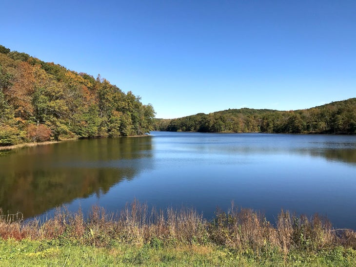 Stopping for a quiet break on Indiana’s Tecumseh Trail (Photo: “Yellowwood Lake – looking north” by sf-dvs is licensed under CC BY 2.0)
Indiana: Tecumseh Trail
Length: 42 miles
Backpacking opportunities may not abound in Indiana, but that doesn’t mean there aren’t any at all. The Tecumseh Trail provides a perfect weekend outing close to Indianapolis. Only an hour drive from the city, it’s easy to reach on a Friday after work or get an early start on Saturday morning. Best done as a shuttle hike, this well-maintained path winds through dense forest, rolling hills, and quaint towns. The scenery is distinctly Indiana: thickly-forested groves, bridges over stream crossings, and a portion of trail along the shore of serene Yellowwood Lake. Three pristine cabin-style and lean-to shelters provide options for overnighters. Two of the shelters were built in the last two years, and they’re ideally located for splitting the trail in half or turning it into a two-nighter over a weekend. Catch splashy fall foliage in autumn, or visit in the middle of winter to have the trail to yourself.
Brian Ainley travels all around the world to mountaineer, backpack, and climb when he’s not exploring near his hometown of Carmel, IN. He summited Aconcagua in 2020 and has climbed Mt. Kilimanjaro.
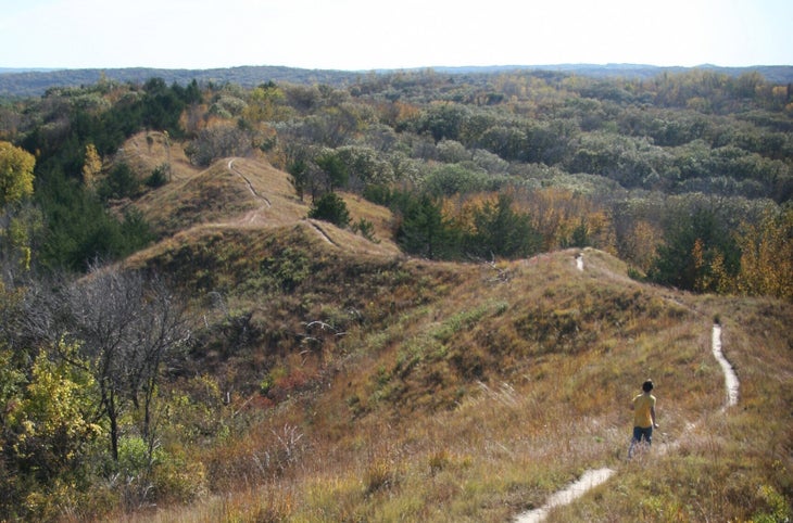 The ridges of the Loess Hills are a welcome surprise in Iowa. (Photo: “A Loess Hills ridge-top trail” by exit78 is licensed under CC PDM 1.0)
Iowa: Brent’s Trail
Length: 8 miles
Think there’s no such thing as ridgelines in the midwest? Brent’s Trail proves otherwise. You’ll use your quads plenty on this hilly adventure through hardwood-forested valleys, grassland, and over rounded spines overlooking bucolic farmland. Formed over thousands of years from windblown soil, the Loess Hills make for 1,600 feet of elevation gain over 8 miles (arrange a shuttle, or relive the wonder to make it a 16-mile out-and-back) with plenty of opportunities for dispersed camping along the way. From the high point at nearly 1,500 feet, take in the placid views of vast prairie, rolling forested hillsides, and neat fields below. The well-maintained trail winding up challenging-yet-approachable grades is a treat for flatlanders, as is the ample shade from dense oak, walnut, hickory, and elm trees. With this gem in my own backyard, I know that even the Midwest has something special to offer hikers.
Amy Alvarez is a working mom of three from Davenport, IA. She enjoys taking her kids hiking around the Midwest and watching them form their own connections with the outdoors.
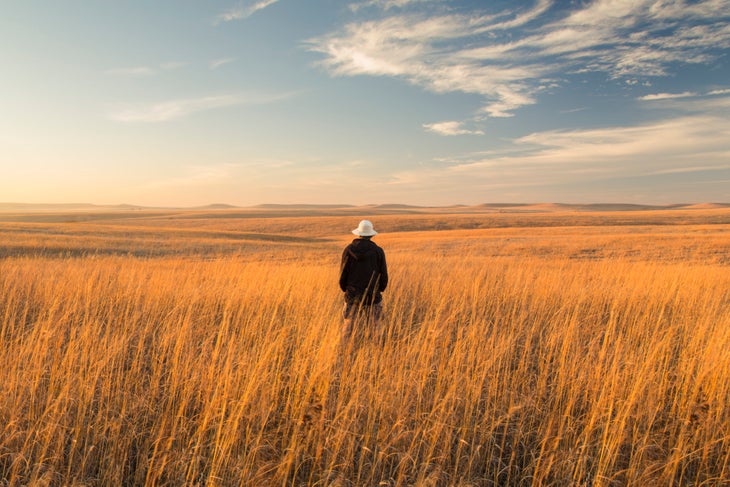 A hiker taking in the endless view of the Kansas prairie at sunset. (Photo: Eddie Brady/The Image Bank via Getty Images)
Kansas: Tallgrass Prairie National Preserve Scenic Overlook Trail
Length: 3.2 miles
Roam with wildlife on this mellow trail through open Windmill Pasture in Tallgrass Prairie National Preserve. There’s plenty of tranquility to be found amidst the rustle of waving switchgrass and birdsong from nearby sparrows, warblers, and finches; nearly 150 species of birds can be spotted on the preserve. Limestone deposits along your route tell the story of when the area was once a vast body of water that geologists call the Permian Sea. From the overlook at almost 1,500 feet (about 3 miles from the visitor center), take in panoramic views of rolling grass prairies, clusters of cedar trees in the distance, and a herd of reintroduced bison (make sure to observe them from a safe distance). In spring, sunflowers and asters bloom among the lush green grasses, creating an explosion of color. From the overlook, extend your hike onto one of the many other trails on the preserve, or head back to the visitor center.
Buffy ““Compass” Sawyer grew up in south-central Kansas and discovered hiking when she moved to the Pacific Northwest. She’s thru-hiked England’s Cotswold Way and section-hiked long trails across the U.S. “Whatever trail I am on, I feel blessed to enjoy the peace and adventure that only the outdoors can give,” she says.
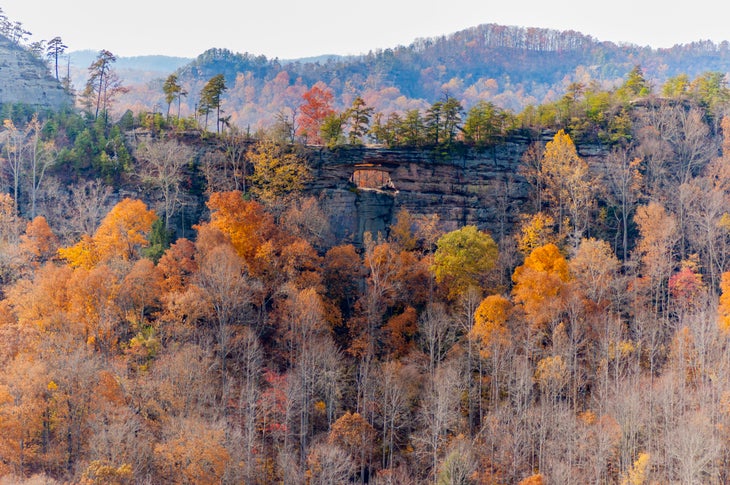 Autumn in Red River Gorge in Kentucky. (Photo by: Education Images/Universal Images Group via Getty Images) (Photo: Education Images / Contributor/Universal Images Group via Getty Images)
Kentucky: Sheltowee Trace Trail
Length: 343 miles
Walking the Sheltowee Trace National Recreation Trail is like attending a 343-mile-long geology lesson. Towering sandstone cliffs, cavernous ravines, and steep rocky ridges—the result of millions of years of weathering and erosion—form a scene that turns more dramatic with each step. White blazes link this path across the 708,000-acre Daniel Boone National Forest—one of my family’s favorite outdoor-adventure getaways, stretching from eastern Kentucky to northern Tennessee. Start just north of Morehead, a small Kentucky trail town bursting with comfort food, then make your way south and prepare to be amazed.
By mile 70, the Red River Gorge’s looming cliffs and soaring arches shade the trail. Sheltowee Trace meanders through the heart of this rock-climbing destination, known as “The Red” for its bright sandstone. Take a quick detour through Natural Bridge State Resort Park just before mile 84 to admire The Red’s most famous attraction: a 78-foot-wide sandstone arch that towers 65 feet above the deep green hemlocks and pines.
Continue south to reach Cumberland Falls State Resort Park. In this “Niagara of the South,” the Cumberland River plummets 60 feet into a boulder-dotted gorge. The hike’s final 100 miles wind through equally as impressive topography, with a patchwork of sandstone bluffs, arches, and gorges in Big South Fork National River and Recreation Area. Hikers relish Sheltowee Trace’s final views alongside the area’s four-legged residents: black bear, bobcats, elk, and gray fox. This enchanting two-to-three-week trek shows a wilder side of Kentucky—a side those of us born and raised around coal country are excited for the world to see.
Stephanie Vermillion was born and raised in Ohio. She currently lives in Cleveland and spends most non-working hours exploring her home region’s beauty while leaving no trailmix M&M left uneaten.
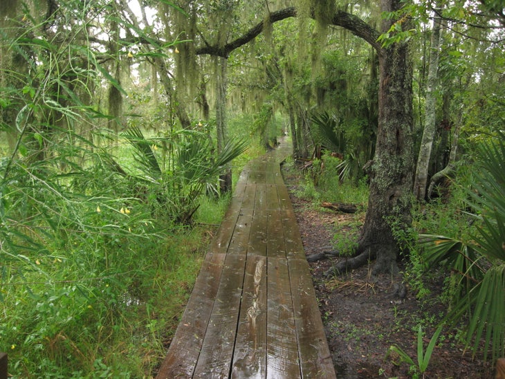 Hiking Louisiana? Get ready to get a little wet. (Photo: “Barataria Preserve, Jean Lafitte National Historical Park and Preserve, Louisiana (13)” by Ken Lund is licensed under CC BY-SA 2.0)
Louisiana: Bayou Coquille Trail and Marsh Overlook Trail
Length: 1.8 miles
The Bayou Coquille trail rambles along the edge of a peaceful wetland, the ancestral home of the Chitimacha and Houma Tribes and, historically, the pirate Jean Lafitte, who temporarily abandoned his life of crime to defend New Orleans during the War of 1812. Before that he and his brother ran a succesful smuggling port in the bay this bayou borders. The winding path tempts hikers into slowing down and immersing themselves among the live oaks and giant palmettos. Every season brings a new surprise, from the native irises blooming in the spring to the palm-sized lubber grasshoppers ambling about in the heat of the summer. Where the Bayou Coquille Trail meets the Marsh Overlook Trail, the path changes from dirt to a wooden boardwalk through a storybook cypress-and-tupelo swamp. Giant golden silk spiders spin webbed walls along the route, while only steps away, alligators peer over the water’s edge. Near the end of the trail, the boardwalk rises into a bridge over the Pipeline Canal/Upper Kenta Canal, offering a glimpse of the distant skyline of downtown New Orleans. From there, drop to an elevated platform with expansive views of a freshwater marsh, its gently waving grass reaching out to the horizon. Bayou Coquille is a prime example of the timeless bayou wilderness that makes Louisiana special.
Kristy Christiansen lives in New Orleans, LA, with her husband and three boys. When not hitting the trails in Louisiana, they travel the country collecting National Park Junior Ranger badges.
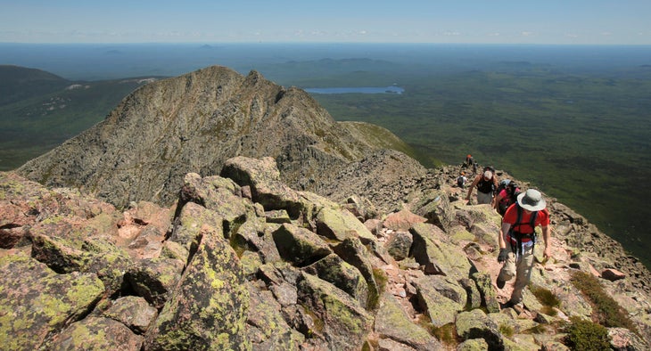 Hikers traverse the Knife Edge near South Peak on Katahdin in Baxter State Park. (Photo by Gregory Rec/Portland Portland Press Herald via Getty Images) (Photo: Portland Press Herald / Contributor via Getty Images)
Maine: The Knife Edge
Length: 2.2 miles
We’re atop Baxter Peak, the highest point on Mt. Katahdin in Baxter State Park. On any other day we might lounge here for hours, but this time my group is on the move: Clouds are rolling in, and we want to experience the exposed Knife Edge in all its glory before they arrive. We tiptoe out onto the mile of sharp, rocky ridgeline, the world dropping away to either side. from our new viewpoint we gaze down on Chimney Pond, nestled among the myriad smaller peaks in the park, where we began our approach; on our right, the leafy wilderness extends for miles, hiding the road we drove in on. The Knife Edge itself varies from smooth, along the flat spine of the ridge, to jumbled boulders requiring scrambling with nothing but air on either side. Halfway across our tightrope journey, we sit to snack on a flat rock. Now that I’m not focused intently on watching my footing, I can truly absorb the view I’ve been surrounded by this whole time; endless forests to the horizon, broken by a few ponds and smaller peaks. I scoot to the edge and let my feet dangle over—it’s like I’m sitting at the rim of a giant bowl made of jagged rock. Filled with awe (and a few handfuls of GORP), we continue along the Knife Edge. The clouds never do roll in, so the woods below remain our backdrop as we revel in the airy feeling of our 5,000-foot-high perch. An hour after setting out, we arrive at Pamola Peak, the other end of the ridge. It’s named for the moody Penobscot god of storms, but today he must have been in a good mood.
August Posch lives in Portland, ME, and loves to hike and run to the top of mountains all across the Northeast. He enjoys wearing brightly colored shoes, and he always carries an extra snack.
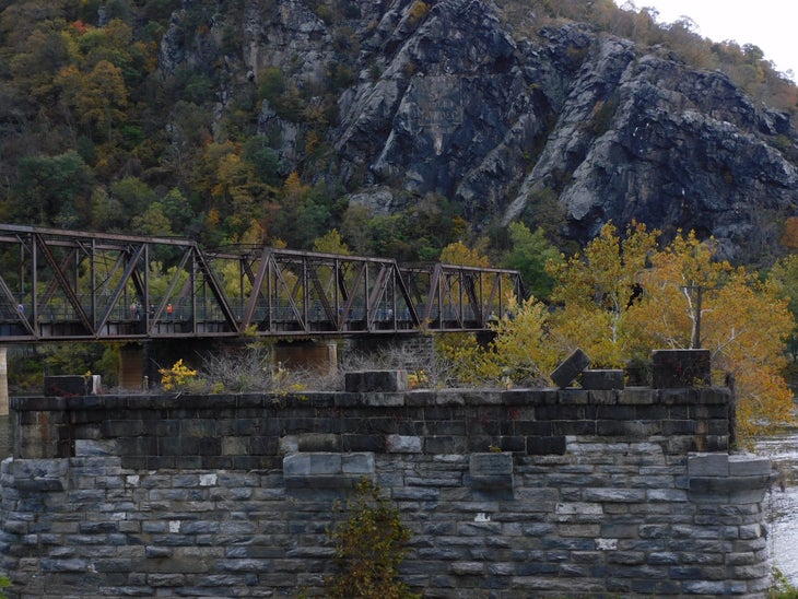 There’s history on the Appalachian Trail in Harper’s Ferry. (Photo: Ashley Hajimirsadeghi on Unsplash)
Maryland: AT from Harper’s Ferry to Pen Mar Park
Length: 41 miles
Considered easy by thru-hiker standards, the 41 miles of the Appalachian Trail that run through Maryland are a fantastic backpacking route that can be covered in a few days. The abundant maple and chestnut trees lining the pathway between Harpers Ferry and Pen Mar Park create a peaceful (and wonderfully shady) green tunnel in the summer months, and the comparatively gentle terrain lets even new hikers easily complete a multiday trip.
Those 41 miles still manage to pack in a lot of highlights: Panoramic views of the Potomac River at Weverton Cliffs encompass three states. You also earn striking vistas of rural Maryland at Annapolis Rock and a look into the green Cumberland Valley at Pen Mar County Park. Pen Mar opened as an amusement park in 1877 but has since been converted to a pavilion with a lookout point, plus potable water for backpackers. The well-cared-for trail plus stellar views make this easygoing section of a notorious trail an experience on par with any mountain wilderness.
Nalini Ravindranath, better known as “Hiking Misadventures” on social media, started her outdoor journey in 2014 when she jumped into a six-month trek of the Appalachian Trail. She loves sharing her stories in hopes of inspiring other people, especially women of color, to pursue their own adventures. You’ll never find her on the trail without a Snickers bar.
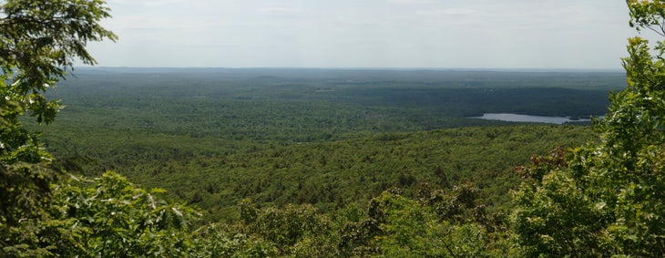 Enjoy sweeping views from Mt. Wachusett. (Photo: “View from Harrington Trail vista on Mt. Wachusett” by xxv is licensed under CC BY-SA 2.0)
Massachussetts: Mt. Wachusett
Length: 3.5 miles
This short and satisfying hike to the summit of one of central Massachusetts’ round mountaintops is our family favorite. Mt. Wachusett isn’t the tallest, longest, or hardest trail in the state: It is remarkable instead for never disappointing, no matter how many times we repeat it. It’s not a strenuous hike, where all the wonder gets squandered from exhaustion. Instead this trail impresses itself gently upon us, and we love it more every time we hike it. As you gain elevation, clamber up ledges of exposed schist to find yourself in the comforting shelter of some of the oldest forest in the state. Red maple, sugar maple, yellow birch, red spruce, and eastern hemlock—some nearly 400 years old—keep you company on the climb.
At the junction with the Harrington Trail, turn right towards the summit. This short, steep section will bring you to the mountain’s flat apex. On clear days, spot the granite bulge of New Hampshire’s Mt. Monadnock to the north, the soft green hump of Mt. Graylock to the west, and the skyline of Boston to the east.
In our opinion, though, the trail is best in the winter, when it’s emptied of people and often covered with snow. As our boots crunch over frozen leaves, we stop and listen. Beneath the snow and ice, water trickles slowly on its course down to the mountain, where it will ultimately drain into the Ware River. This is the reason we return to nature, again and again; this is peace.
Aloyah Isa lives in central Massachusetts and loves to explore and contemplate in the magical woods that surround her. On the trail, she snacks on Lily’s coconut dark chocolate.
Endria Richardson is a queer Black and Malaysian writer, editor, and climber from Worcester, MA. Her favorite trail snack is canned smoked oysters or sardines paired with Triscuits.
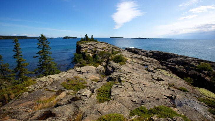 The Greenstone Trail is a long, occasionally lonely trek across an island. (: Tim Bieber via Photodisc/Getty Images)
Michigan: Greenstone Ridge Trail
Length: 43 miles
There’s no easy approach to the Greenstone Ridge Trail, the 43-mile traverse of Isle Royale National Park. You’ll need three hours to cross Lake Superior from the ferry dock on Michigan’s mainland (45 minutes if you splurge for seaplane tickets) and have to time that for between spring and fall, when the ferry operates. But Isle Royale’s isolation is precisely the reason to visit. After leaving the Superior-splashed gray rocks at Windigo, the trail climbs through spruce forest, with knee-high ferns to either side. The dominant color is deep green except for tiny white Canada Mayflowers and pink lady slippers. By late summer, the forest’s thimbleberry crop is so prolific that ripe fruit litters the trail, making any moment a good time for a snack break.
Twenty miles in, the Greenstone breaks out of the forest. Wild roses and bluebells line the trail as it passes through thigh-high grass meadows. Scramble up exposed granite knobs or climb Mt. Ojibway’s old fire tower for views that open up to the area’s main attraction: Isle Royale’s narrow, rocky inlets to the east, Rock Harbor Lighthouse to the south, and Ontario to the north. At dusk, you’ll hear the tremolo calls of the island’s resident loons and, after dark, a million stars illuminate a sky free of light pollution. And you’ll have it all to yourself.
The Greenstone traditionally finishes with a burger and beer at Rock Harbor Lodge, Isle Royale’s only hotel and restaurant. With a little luck, you’ll encounter the island’s favorite mammal here, the moose. You’re unlikely to stumble across this lumbering giant along the Greenstone, partial as it is to the sheltered coves of Lake Superior. But moose make an exception for the tidy lawns surrounding the lodge; like backpackers, they appreciate an easy meal.
Amy S. Eckert is a Michigan-based outdoor writer known on the trail as “The Happy Wanderer.” She makes a point of saving space in her backpack for her too-heavy-but-beautiful wildflower identification book.
 The 1.6 mile Cakewalk north of Grand Marais is the only section of trail that runs along the shore of Lake Superior outside of the Duluth Lake Walk. (Photo by Brian Peterson/Star Tribune via Getty Images) (Photo: Star Tribune via Getty Images )
Minnesota: Superior Hiking Trail
Length: 310 miles
Thirty-five years ago, the idea seemed ludicrous: Build a miniature long trail in Minnesota’s Arrowhead region, snugged against Lake Superior’s North Shore. But the locals knew what they were doing. The land they had in mind encompassed a portion of the jagged Sawtooth Mountains, Superior National Forest, eight state parks, and the shores of Lake Superior. It would be a challenging trek, but the rewards would be plenty: dense forestland, thundering waterfalls, rushing rivers, and steep, rocky crags offering panoramic views.
Today, the Superior Hiking Trail (SHT) is consistently ranked among the nation’s finest long trails. The 310-mile path’s southern end starts in the deep woods on the Minnesota-Wisconsin border, just south of Duluth. Its northern terminus is the remote 270 Degree Overlook near the famed Boundary Waters. Standing atop this rocky promontory, you can see straight into Ontario, Canada.
Stunning as this path is, you must take any trip along it seriously. While the SHT generally tumbles atop the soaring bluffs lining the North Shore, these outcroppings are repeatedly sliced apart by a series of rivers that rush into Lake Superior with a frenzied roar. This means you’ll be scrambling up and down those drainages over and over again. Don’t let that distract you from the beauty, though. My personal favorite section is Pincushion Mountain, near Grand Marais, where the view over the forest and Lake Superior has to be seen to be believed.
Thankfully, the trail’s brutal elevation changes (over 60,000 vertical feet) are overshadowed by its beauty. Think eye-popping views of Lake Superior, a vast, sapphire blanket that melts into the horizon; stately stands of oak, aspen, spruce, and birch; terrain that’s covered in colorful wildflowers in spring, then fiery red and orange foliage come fall. There are fun surprises, too, like the popular swinging bridge in Jay Cooke State Park and the Drainpipe, a 150-foot-long scramble through a rocky crevice in Tettegouche State Park.
Like the Appalachian Trail, the SHT is dotted with established campsites and numerous trailheads, making it easy to access. Local shuttle services assist with hikes of any length, and the North Shore towns make it simple to resupply. Between those amenities and the excellence of the trail itself, it’s perfect for backpackers of any experience level.
Melanie Radzicki McManus writes about hiking, travel, and fitness from her home in Sun Prairie, WI. During the last decade, she has hiked more than 9,000 miles around the globe, including thru-hikes of six of America’s 11 National Scenic Trails. True to her home state, her favorite trail snack is fresh cheese curds.
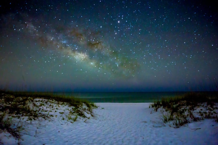 See the Mississippi coast on the Davis Bayou Trail. (Photo: “File:Ft Pickens,Gulf Islands National Seashore (NRHP-13208).jpg” by Richard A. Weaver is licensed under CC BY-SA 4.0)