Freeze warning comes after hail reported throughout San Francisco Bay Space

A cold front passing over the San Francisco Bay Area brought chilly weather and widespread hail on Tuesday, and the National Weather Service said “much colder temperatures” are coming with a freeze warning in effect for many locations through Friday morning.
There were reports of hail across the region, from the North Bay to the South Bay, on Tuesday evening, and photos and videos posted in social media showed landscapes blanketed in the pea-size ice.
The South San Francisco Fire Department reported hail on roadways and warned people to drive with caution, and images from Danville showed a thick layer of icy slush on the ground.
@NWSBayArea hail Danville! pic.twitter.com/4XrqAsqS4W
— Mike Perchak (@mperchak) February 23, 2022
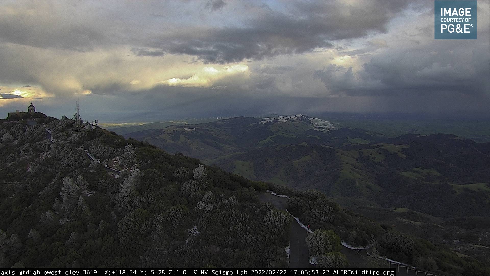
Snow fell on the highest mountain peaks, including Mount Hamilton in the South Bay and Mount Diablo in the East Bay. Video from the Maycamas Mountains that extend into Sonoma and Napa counties showed a period late Tuesday afternoon when relatively heavy snow fell at an elevation of 1,700 feet.
Still snowing at 1700 feet in the Mayacamas. @NWSBayArea #CAwx pic.twitter.com/znKUYaLmYG
— Marc Schwager (@CavedaleRhones) February 23, 2022
The cold front ushered a mass of frigid air into the region, and after skies cleared overnight, already chilly temperatures dropped even further. Early Wednesday morning, lows dipped into the low 30s in inland valleys, with some spots even dipping into the bone-chilling 20s. Low 30s were reported in the East Bay hills, North Bay hills and Diablo range. Coastal spots are expected to stay in the low 40s, and San Francisco hit 42 at 3 am Wednesday.
The weather service has a freeze warning in effect from 2 am Wednesday through 9 am Friday with widespread sub-freezing temperatures expected across inland areas.
Frost and freeze conditions will kill crops, other sensitive vegetation and possibly damage unprotected outdoor plumbing,” the weather service warned.
Freeze Warning updated to include inland portions of the South Bay such as San Jose. Take action now to prepare and check on those without adequate access to shelter, including your pets. #cawx pic.twitter.com/4GgnY8NUcS
— NWS Bay Area 🌉 (@NWSBayArea) February 22, 2022
San Francisco and most of the Peninsula aren’t included in the warning, but on Tuesday the weather service added the Santa Clara Valley.
Through Thursday, afternoon highs across the region will be in the 50s. Friday afternoon will be slightly warmer with highs getting into the low 60s. By Saturday afternoon, Santa Rosa is expected to hit a high of 62 degrees with Oakland and San Francisco hitting a high of 63.
Long-term weather models show the next chance for rain in early March with the current forecast showing only light precipitation with only a few hundredths to a tenth of an inch of rain.


